ATAK is an Android®-based GIS moving map application. WinTAK is Microsoft Windows®-based. ATAK was developed to provide SpyGlass-like C2, Situational Awareness and planning capabilities on smartphones and tablets. WinTAK was developed to provide a Windows-based application with a user interface similar to ATAK.
ATAK/WinTAK provides ground users and pilots a meaningful, geospatial site picture and inter-operates with other situational awareness tools including SpyGlass, RaptorX, FalconView, and other legacy systems. Both support most of the standardized image/map formats. Its standalone capabilities include moving map functions independent of cellular/Wi-Fi network. Additionally, these mobile applications allow maps to be loaded during mission pre-planning or execution phase. It utilizes internal and external GPS sources
ATAK variations are currently utilized by many branches of federal, state, and local governments and partner nations.
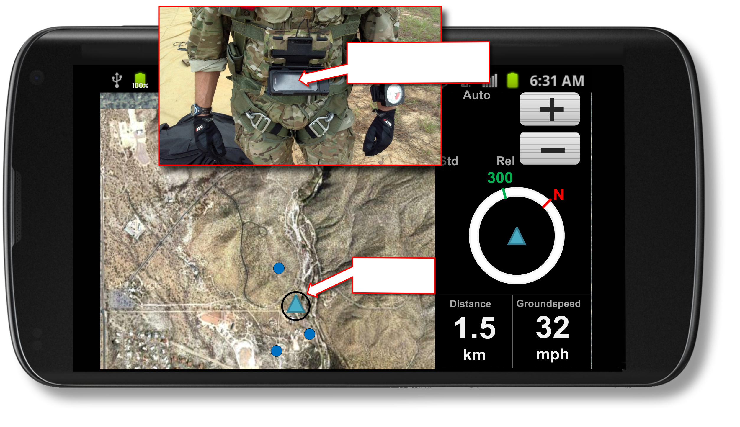
Situational Awareness software operating on a Android Smartphone
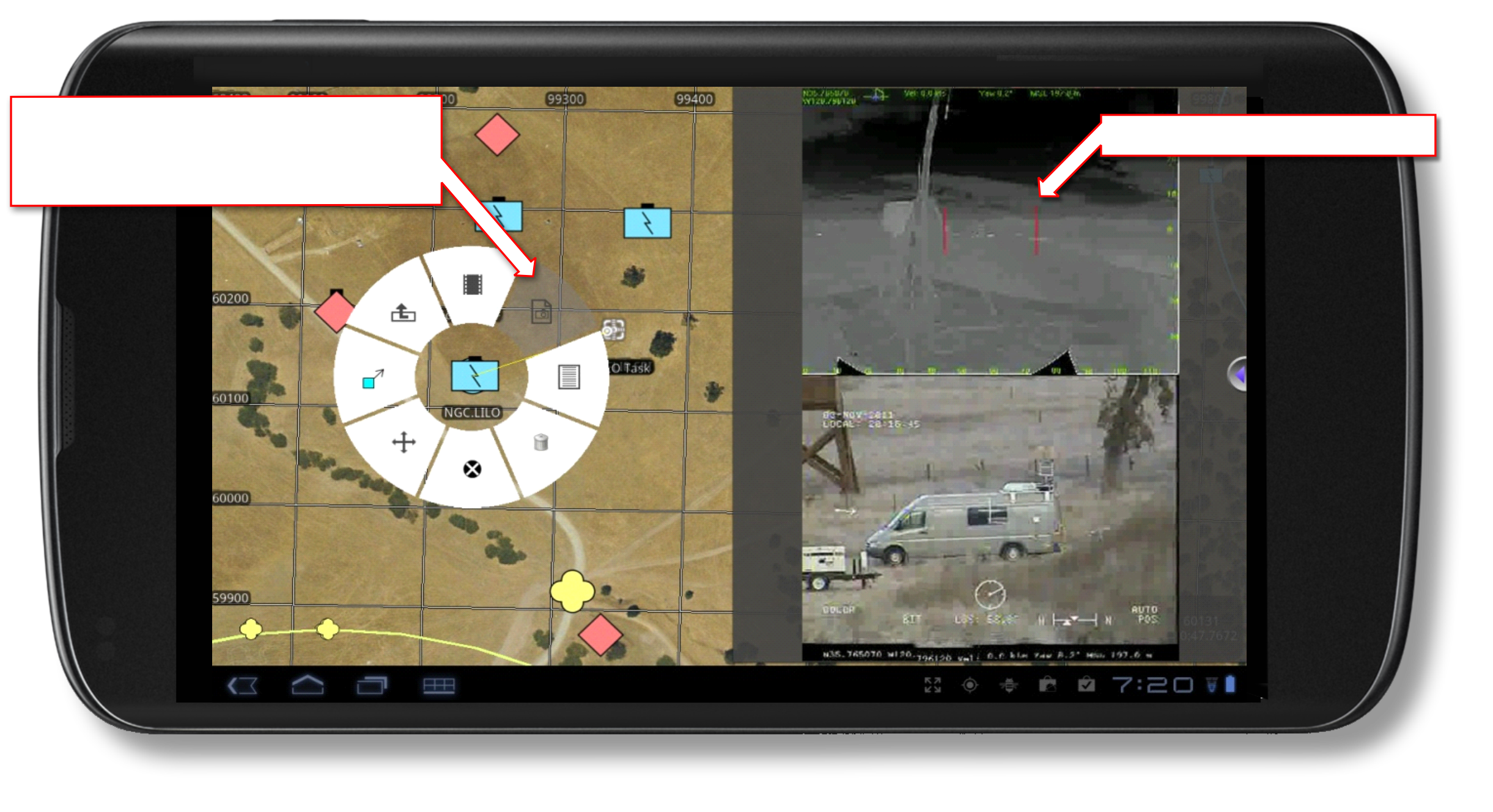
Radial menu – reduces critical
tasks on average 60% compared to Falcon View
Integrated video viewer
Android Smartphone
mounted on chest.
Self Location
ATAK (Android Team Awareness Kit)/WinTAK Software)
INNOVATION