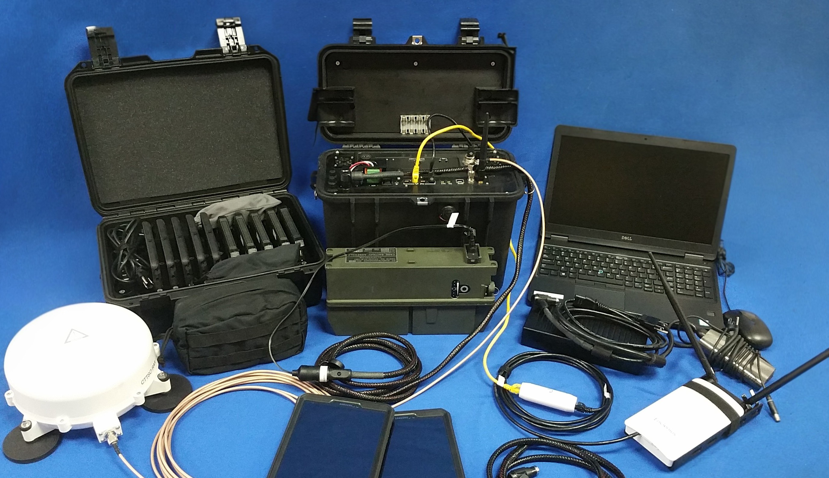
Product Overview
The Data Island is a portable, integrated networking suite designed to establish secure, reliable communication in austere environments. Whether operating in disconnected, intermittent, or limited-bandwidth conditions, Data Island enables real-time situational awareness through mesh networking, TAK integration, and satellite-based backhaul connectivity.
With built-in TAK server capabilities, GeoServer map hosting, and multi-domain interoperability, Data Island ensures continuous mission effectiveness for military, public safety, and disaster response operations.
Key Features
Tactical Network Anywhere
Establishes local and wide-area connectivity via SATCOM, cellular, or Wi-Fi backhaul, ensuring data access in any environment.
Local Mesh Communication
Enables peer-to-peer connectivity without reliance on external infrastructure, enhancing operational resilience.
Secure and Redundant Practices
Supports multi-layered encryption, redundant routing, and PACE (Primary, Alternate, Contingency, Emergency) network strategies.
Core Components
Multi-Use Networking Suite
Multiple connectivity options to ensure secure, mission-critical data transfer.
- Integrated SATCOM, CradlePoint LTE, and Wi-Fi backhaul solutions
- Supports SIM-based LTE connectivity with fallback to satellite communications
- Redundant power options with AC, DC, and vehicle-based sources
TAK Server & Local Network Operations
Seamless CoT (Cursor-on-Target) messaging and direct interoperability with ATAK, WinTAK, and other TAK-enabled devices.
- Dedicated TAK server for seamless mission execution
- Support for Cursor-on-Target (CoT) message routing and mission package sharing
- Local CoT mesh networking to ensure real-time coordination
GeoServer & Digital Mapping
High-resolution map data for real-time geospatial awareness.
- Preloaded Web Map Service (WMS) GeoServer for offline map hosting
- Enables real-time geospatial visualization for TAK-enabled devices
- Supports large-scale map uploads and customizable GIS layers
Additional Capabilities
- Housed in a ruggedized transport case for maximum durability and portability.
- Ability to enable Personal Location Information (PLI) tracking for up to 20 targets.
- Validated for mission-critical scalability, ensuring reliable performance in high-demand environments.
- Backup power support ensures seamless transitions between power sources.
Connect With Us
Contact us today to learn how we can assist with your unique needs. Our team is ready to provide expert solutions tailored to your requirements.
Contact Us Now →